
A loop along the stone walls of Gochang-eupseong
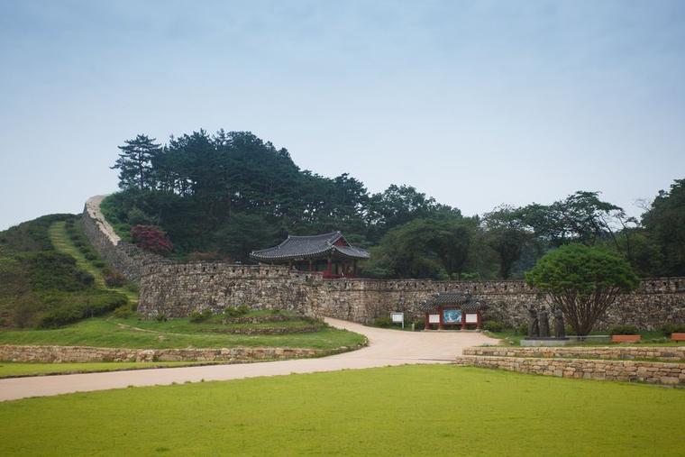
Gochang-eupseong in North Jeolla Province is a Joseon-era walled town whose natural-stone ramparts climb a hillside. Also known as Moyangseong, it can be toured on foot past its walls, gates and restored government buildings.
The national heritage portal dates the fortress to early Joseon. Its stone enclosure and old government compound survive together, and the Korea Tourism Organization gives the wall’s circumference as 1,684 meters.
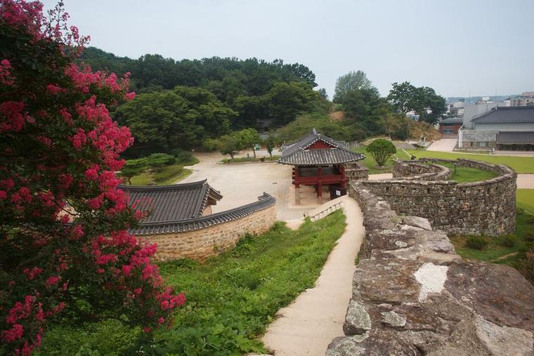
Around Gongbukru, straight sections of wall meet rounded defensive bastions. Visitors who prefer a shorter outing can keep to the entrance and the interior rather than the full rampart walk.
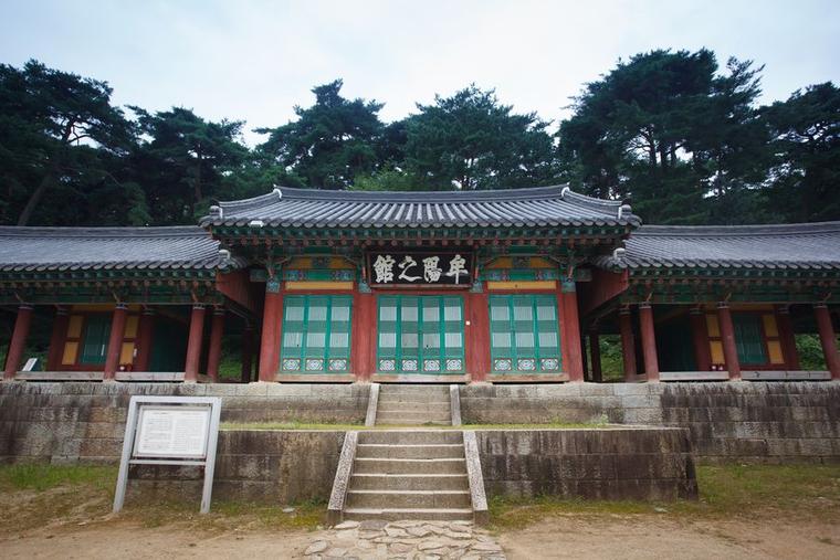
Inside are government buildings such as Moyangjigwan. Not all are originals: Gochang County says they were rebuilt through a restoration project that began in 1976.
Stone walls climbing a hill, gate architecture and restored administrative buildings sit together within the enclosure.
Best Time
Daylight makes it easier to check uneven surfaces and wall edges. Stone paths can be slippery after rain, and local restrictions may apply. All photographs shown are from 2015 and may not reflect current flowers or foliage.
How Long
Allow 60–90 minutes for an unhurried visit to the entrance and interior. The estimate does not assume a full circuit of the walls.
Getting There
The Korea Tourism Organization lists the address as 1 Moyangseong-ro, Gochang-eup, Gochang-gun. The county’s official listing links to a map. Local connections and return transport must be arranged separately.
PLACE INFO
LOCATION
Source Korea Heritage Service / KOGL Checked 2026.10.10 03:06
Sources & context
2026-10-13T10:32:58.466Z
Korea Heritage Service / KOGL ↗Gochang County ↗Gochang County ↗Korea Tourism Organization ↗Korea Heritage Service ↗Korea Heritage Service archive photograph, 2015. Seasonal appearance and site conditions may differ today. KOGL Type 1.
Korea Heritage Service archive photograph, 2015. Seasonal appearance and site conditions may differ today. KOGL Type 1.
Korea Heritage Service archive photograph, 2015. Seasonal appearance and site conditions may differ today. KOGL Type 1.